Yes, this is absolutely true: WHERE THE SUN SHINES … My reddish legs can confirm that an a substantial overexposure to sunlight happened … damn … But let’s start from the beginning.
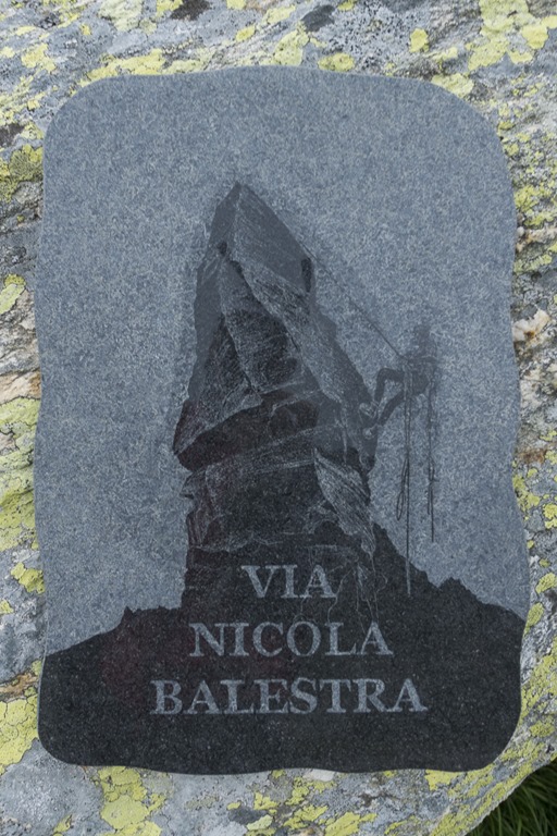
As I was helping a fried of mine to move his household to a new flat on Saturday and to my surprise survived this without any back injury, I spontaneously decide to do some outdoor activity on Sunday. Unfortunately the weather forecast for Sunday was pretty bad for anything north of the alps. So the only option left was go to Ticino, which is south of the alps. The weather forecast didn’t foresee perfect weather there but at least no rain. This year I am planning a multi-day hike in this region where you go from hut to hut or just camp somewhere in the mountains my idea was to checkout some of the trail on Sunday. After some research I decided to go for the last section (which would be day 4) as it seemed somehow better accessible from the valleys below compared to the other sections. Day 4 would go from the Cognora hut to the Barone hut, but at Passo di Piatto there is a special “detour” available for all those who still have some power left after 4 days of mountain hiking. And that was where I planed to join the trail, where the detour starts. The detour is called Via Nicola Balestra to honour a mountain guide from Ticino who died on Mont Blanc
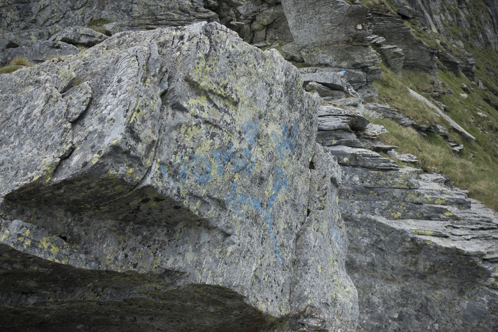
I did some online research about the Via Nicola. Not much information can be found about the trail except 2-3 reports. Some of them are pretty old but most importantly the trail is marked with blue dots and seems to be doable with my skills. So, good! Target set! Now, where are the problems? No problems … kind of … ![]()
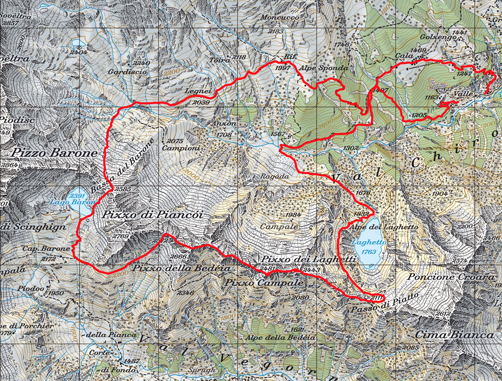
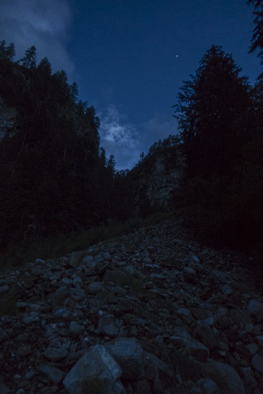
As I wanted to start early, meaning around 04:30 and the starting point was a 2 hours drive away from Zurich I left home around 02:30. At this time of the day there is usually no traffic jam at the Gotthard street tunnel so I reached my starting point in time and without anything worth mentioning. I don’t even worry anymore about the fact that I am constantly forgetting my head lights at home. The 1-2 hours in the dark in the morning I can somehow cover with the “torch” functionality of my mobile phones as you are usually walking on some easy tracks at the beginning of a hike. Today was different! Why? I had stopped to print out the maps of the trails quite some time ago and instead called the online map (Swiss government sponsored @ https://map.geo.admin.ch) on my mobile. Today, when I wanted to do that, I discovered that there was no mobile coverage at the starting point. I knew where I wanted to go, the Passo di Piatto, but not how to get there. Grrrrrr! And there where no hiking signs showing the right direction. And my bright head light was at home. So I started to walk into the direction of the Passo ignoring a large warning sign with a hiker on it. Something in Italian was written on it warning about some hang slide or rocks or whatever. Without mobile coverage I was not be able to translate it anyway and you are doing everything in the mountains at your own risk regardless what is written on that sign. Soon it became apparent what this was about. Some river had obviously washed down a huge amount of stones and soil and walking in the dark on the loose underground wasn’t easy at all. I was still looking for a trail as there was nothing really visible which could be named track. You could see however that other people have walked here and I was trying to follow those not-so-clear tracks. A couple of times I was about to turn around, go back to my car and drive to a location where I would have mobile coverage again to get the map. But then again I was already up quite a bit, so I didn’t want return and instead kept looking for some real trail. By now it was clear that I would not find the official hiking trail and had to find a way up the mountain on my own. I also knew that at some point up the mountain I would get mobile coverage and could check my position. To my surprise when walking up along side a small stream I was suddenly on an ancient trail.
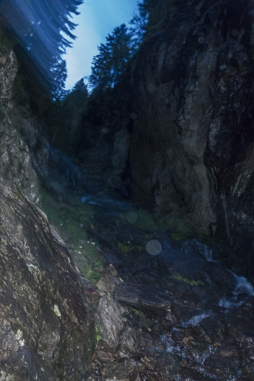
There where some stairs made out of stone and on some steep section there were some ropes. Perfect! I was back in business.
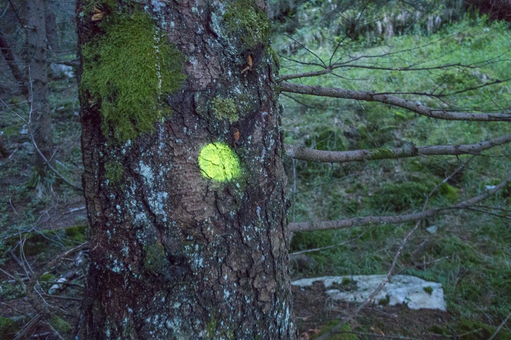
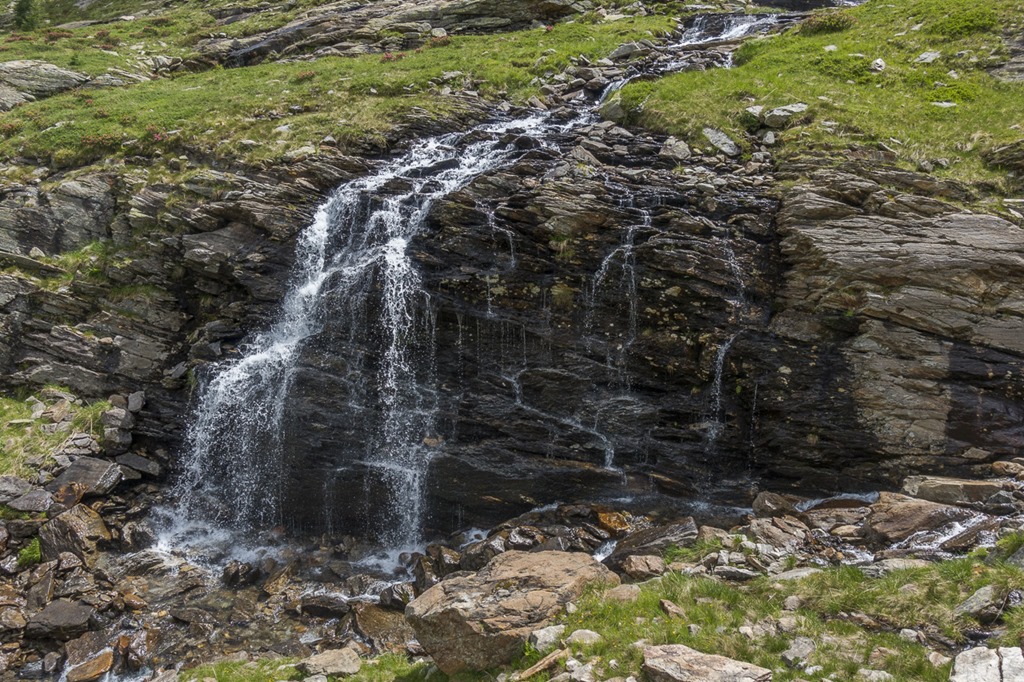
What I didn’t mention so for is the fact that it must have rained quite a bit recently as the ground was very wet and slippery. Combine this with darkness and you get the perfect set to do big slip. And that’s what I did. My backpack was taking the impact so nothing bad happened. I started to like this trail alongside the steam. Now and then you got some drops of water from the many waterfalls which was very refreshing. At some point the mobile signal was back and I could check my position. It didn’t look too bad for me. I was just around 300 meters in altitude below the official hiking trail. Unfortunately the ancient trail eventually disappeared. I was standing in the middle of a forest and had to make a decision: Try to go straight up to the hiking trail or follow the valley further until the trail and my path would eventually meet. At first I was considering the second option because I like this kind of wild terrain but then decided to get onto the hiking trail as quick as possible since I didn’t want too loose too much time. On the way up I came across some recently done marks. I couldn’t figure out why somebody would add those marks here in the middle of nowhere. Eventually I gave up looking for them as they were doing too much zigg-zack and I just wanted to go up in a straight line.
After I was on the official hiking trail everything was clear for the next 1.5 hours. Except on this bridge. It looked quite tilted and the wooden planks have endured many winters. I realised the status of bridge when I was half way through. The prospects of a plank cracking was not overly realistic but I nevertheless continued only making careful steps and made sure my feet were always on 3 planks.
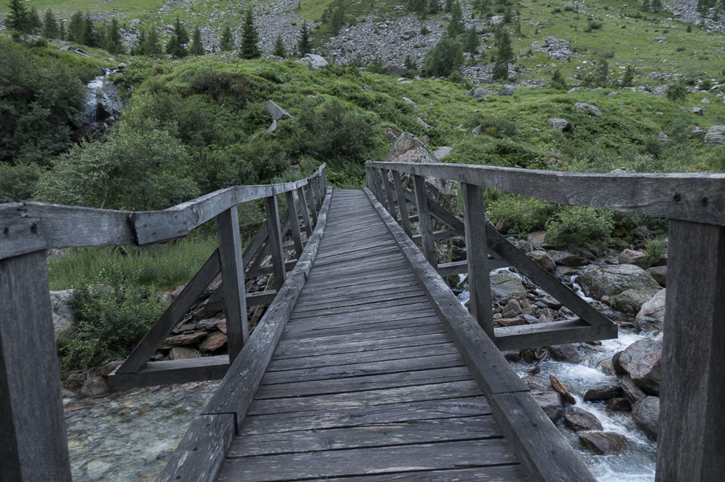
River below.
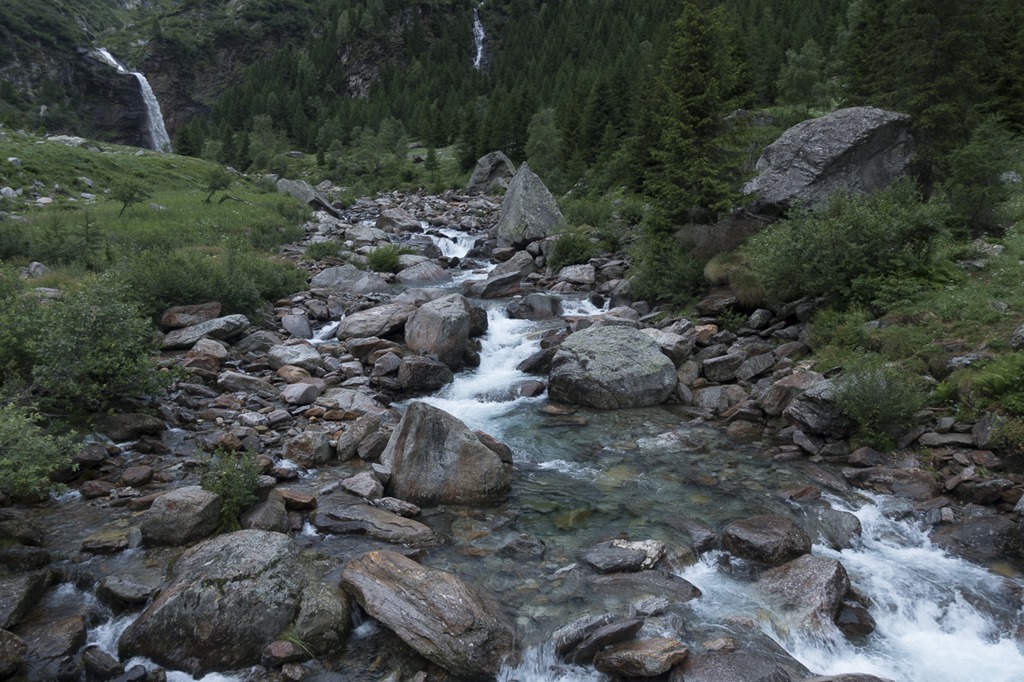
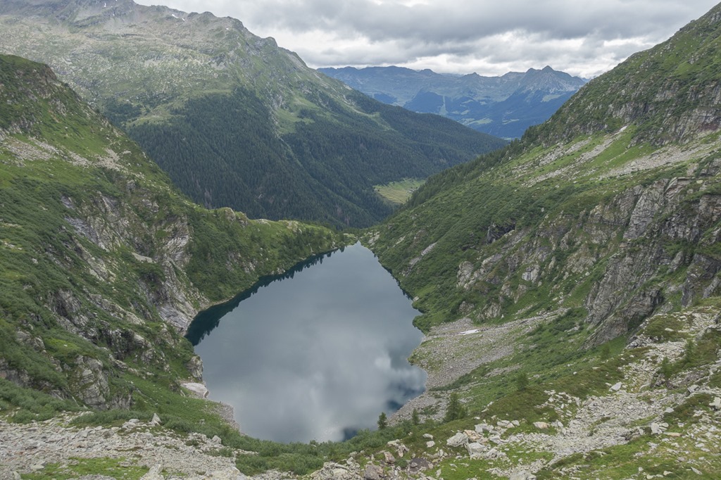
After another 30 minutes of hiking I reached the Laghetto lake where I had my first break. As you can see from the following picture it was not really sunny yet. In fact it was rather chilly but when you are moving this is actually nice as you are not overheating.
It looked like a really nice place to camp. And to my surprise I could see a tent on the other side of the lake. They are stealing my ideas! ![]()
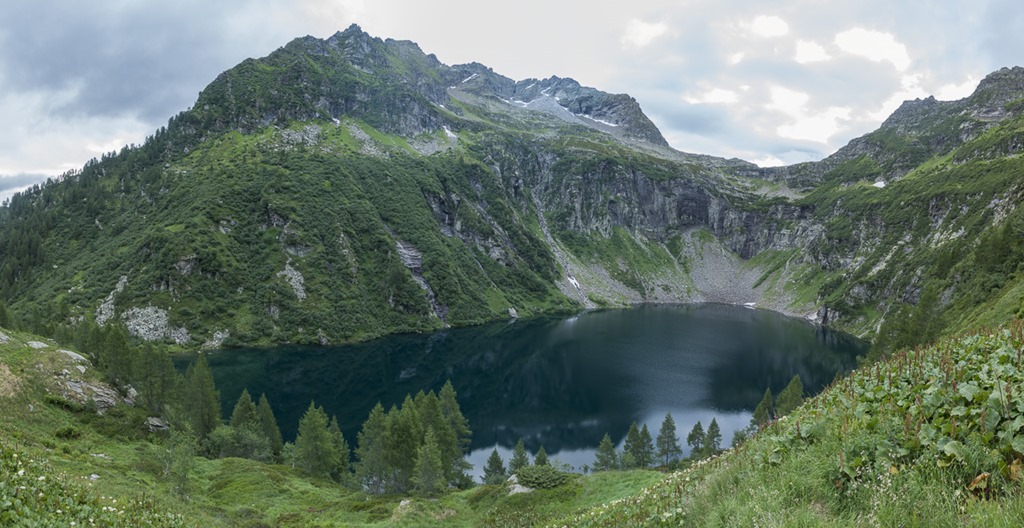
The view of the lake from above.
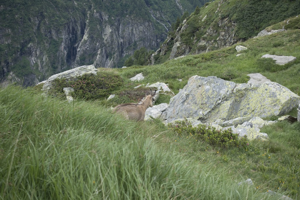
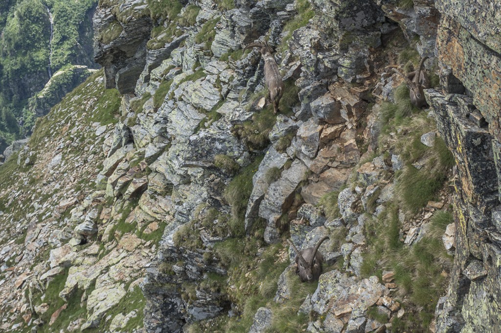
When I mad another stop on the “Passo di Paitto” where the Via Nicola actually started I was closely monitored by a Gemse (Chamois). Usually they flee whenever they spot a human but this one was actually coming closer and closer. But when I stood up in order to take a better photo all the braveness disappears together with the animal.
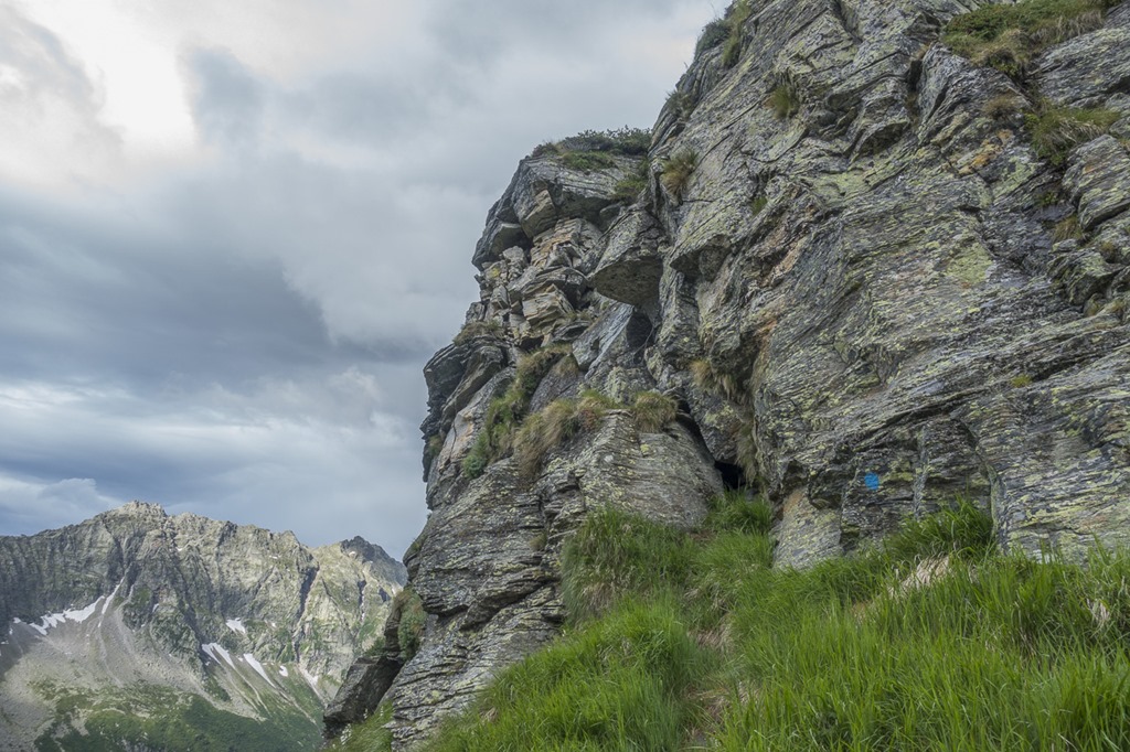
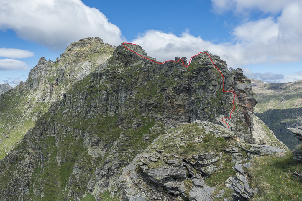
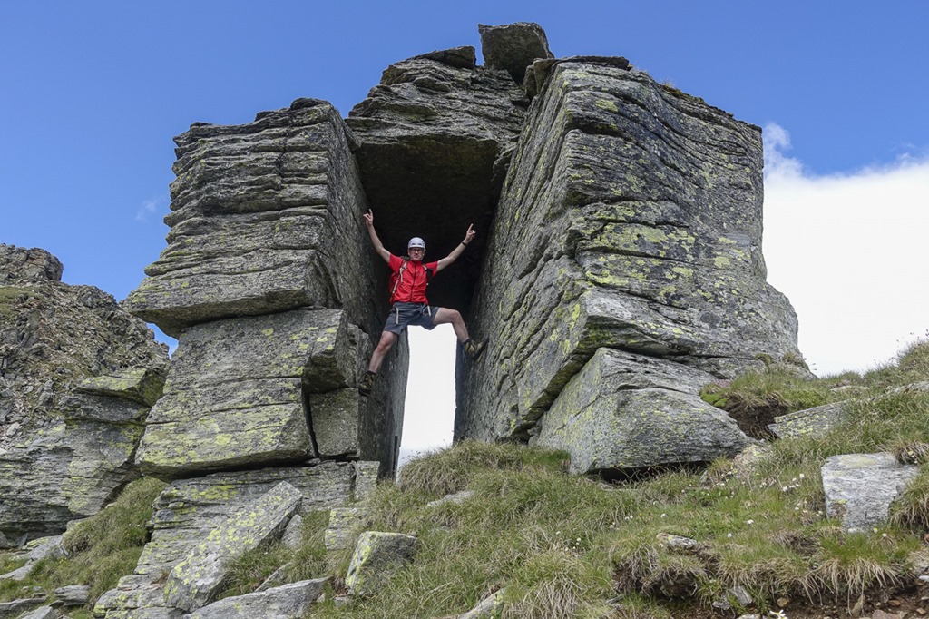
This was the official starting point to the “Via Nicola Balestra”. Don’t get me wrong. This is by far not an normal maintained hiking trail. Sometimes the trail is clearly visible, sometimes it disappears. But it is marked with blue dots. So if you are aiming for the next dot in front of you you can’t get off the track.
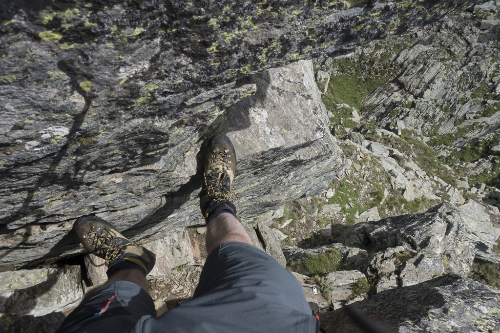
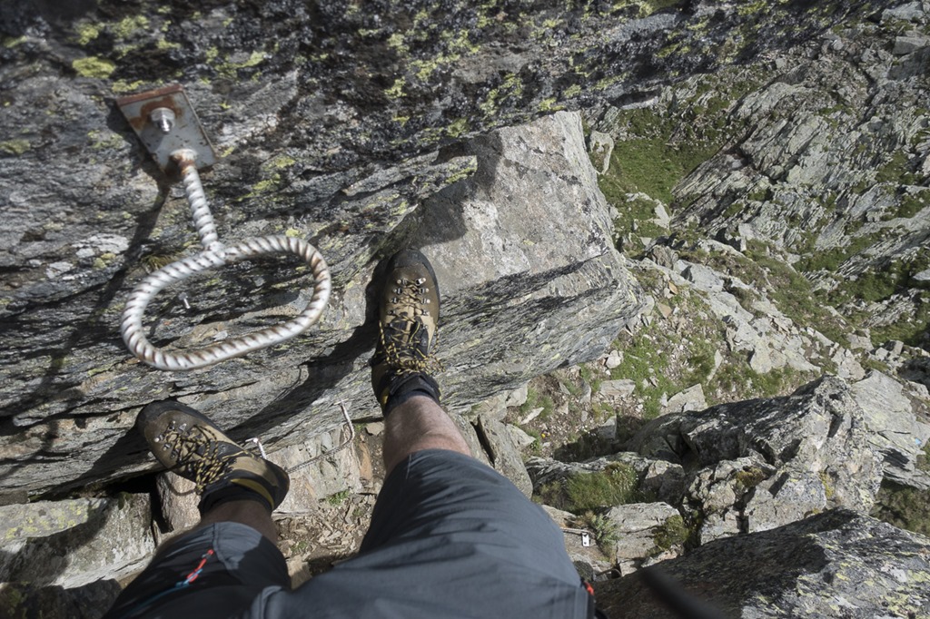
At the very beginning of the trail there was a rather tricky climbing section. It was the only time where a fixed rope was installed in order to help you getting up. The tricky part about this section was not that it was especially steep or exposed. The tricky thing was that the rock was still went and slippery. The metal rope was wet as well and felt very cold. At first I didn’t manage to get enough grip on the slippery rope in order to pull me up but eventually I managed to do it, somehow. Somebody watching me would have laughed and thought: this guy should better get home before it is too late.
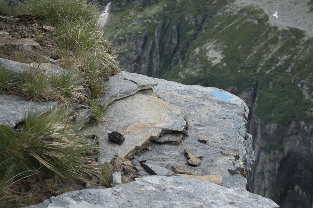
As I already mentioned, the whole trail was marked with blue dots. This doesn’t mean you need to step on every blue dot to get maximum points …
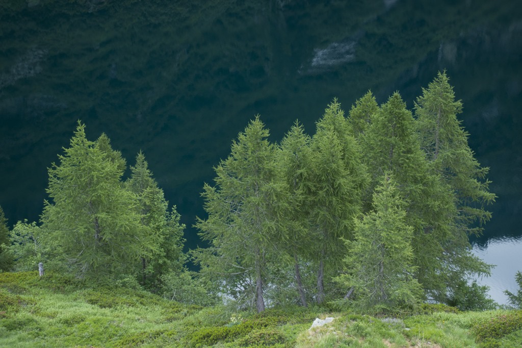
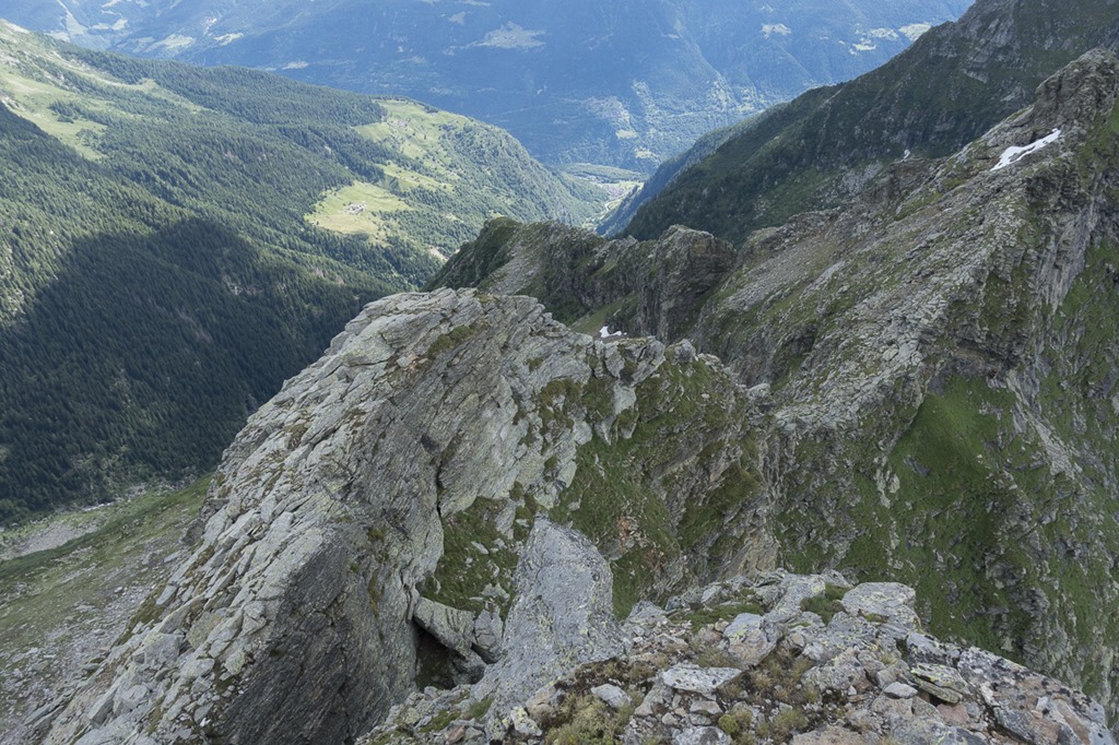
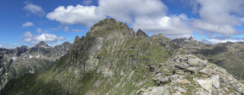
Looking back to the first section of the trail. In general it is following the ridge, so the orientation was easy.
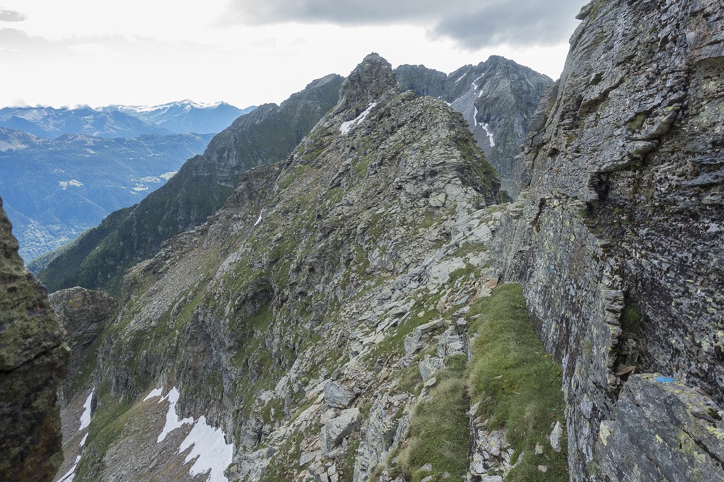
If the path on the ridge gets to steep or is blocked by big rocks the Via Nicola is going around the obstacle in the flank.
The “Steinmännli” of the first mountain. I was surprised how easy it was going so far.
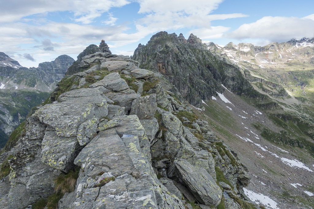
At this point I lost the dots for the first time. They way down from the first mountain looked very steep and without seeing any dots I didn’t even try it. So I went back some meters and crossed it on the the right flank below the summit still without seeing the dots. Once back on the ridge I found the dots again and when looking back I discovered that they would have directed me on the left side around the mountain. Looks pretty steep, doesn’t it? I would say I am happy with my decision to go on right side.
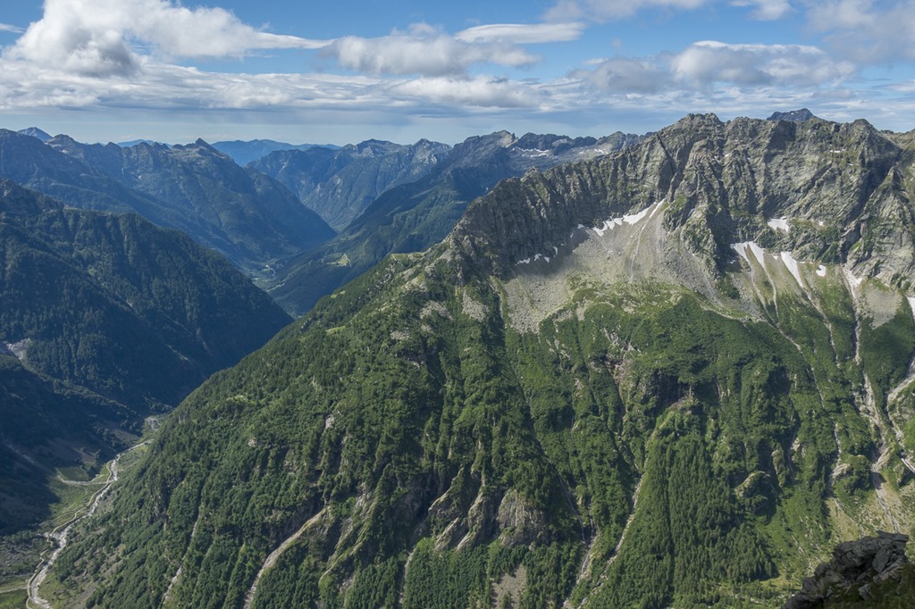
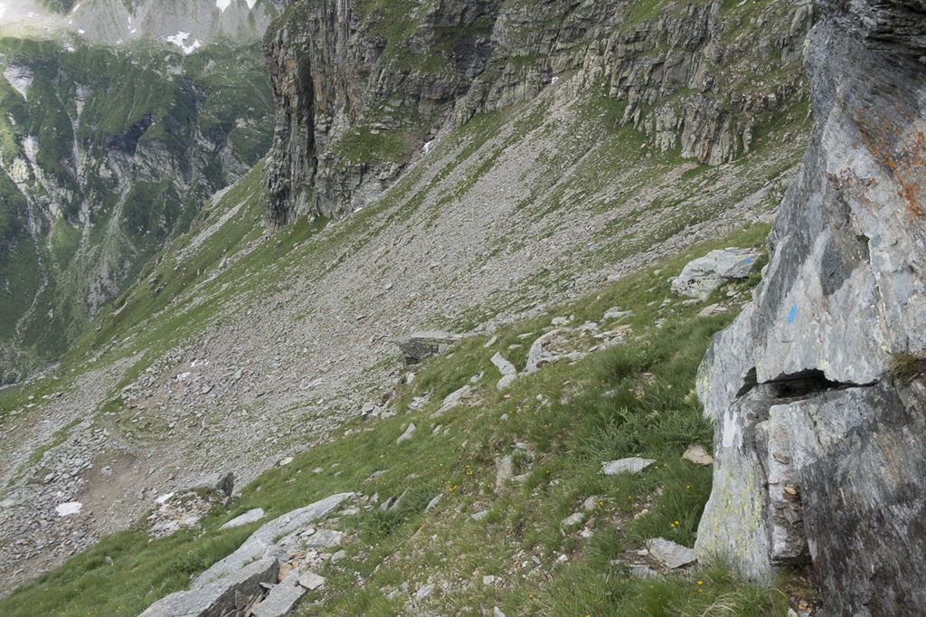
Looking into the other direction I was able to observe the way ahead of me. Lots of rocks ahead.
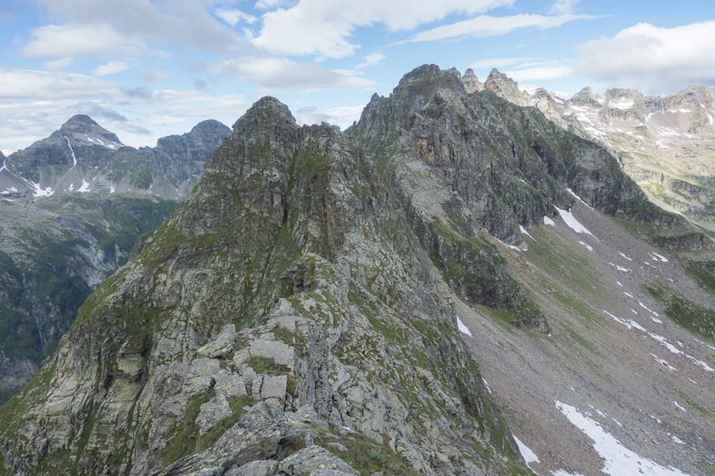
Another spot where you go into the flank in order to bypass some obstacle. View back to the first mountain.
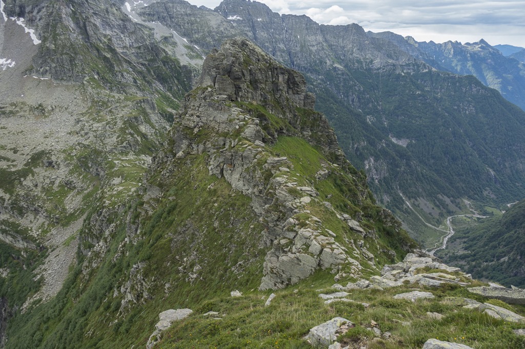
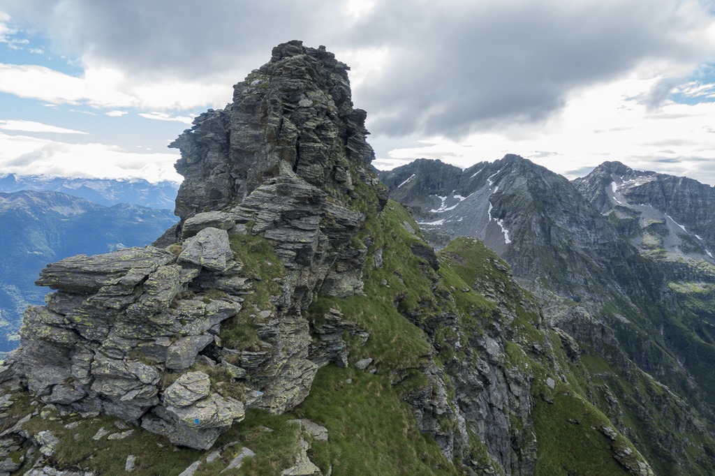
Getting up the second mountain was substantial more difficult compared to the first one but still well within my reach. Lots of fun and always interesting to to see how you could “hike” up a mountain which from below seems to be not accessible. View back onto the ridge.
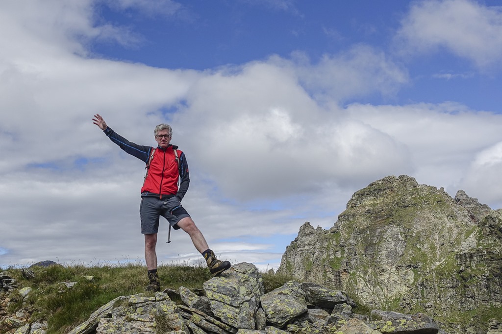
So, this was my second mountain today! Time for a summit picture. I knew from my research about the Via Nicola that there would be two mountains and I would bypass the third one on the left side on the normal hiking trail as it is not part of the trail and potentially too difficult from this side for a hiking style adventure. Yeah, the next mountain on the ridge looked really steep. So this was the “Via Nicola Balestra”. Perfect!
On the way down from the second mountain I was looking around a bit to enjoy the nice scenery. The sun was clearly winning the battle against the clouds as they where disappearing more and more.
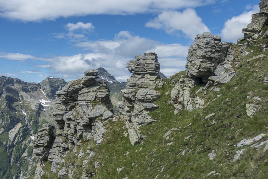
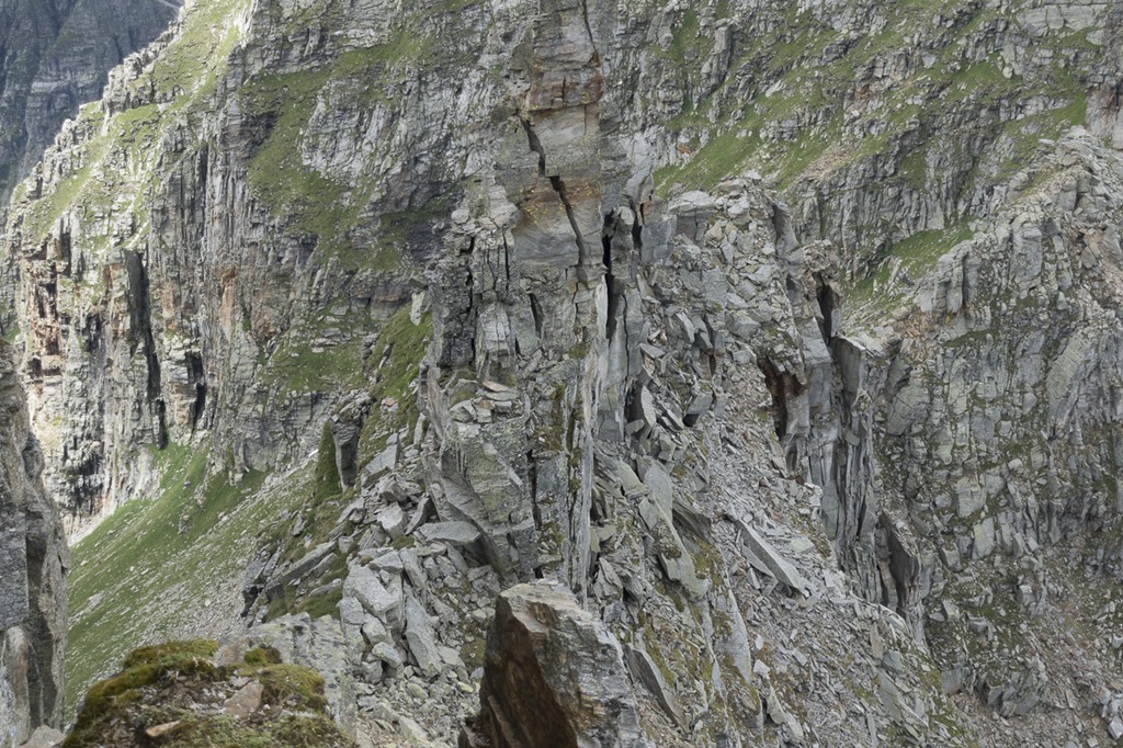
Interesting looking formation of rocks.
As I said before, I was not going to try the third mountain on the ridge. So I was expecting that the blue dots eventually would lead the way to the normal hiking trail which was well below. To my big surprise, when I reached to lowest point after the second mountains the blue dots where pointing straight ahead steep up again. What the f* is going on here?! As I was consulting the map on my mobile phone I discovered that there are actually four mountains on the Via Nicola and I just passed the second one. So I was just half way through. And the one in front of me which I had considered as being difficult was part of the trail … bugger! ![]() This was kind of a damper of my confidence. Some coke and food restored it and I continued on the second half of the trail. It turned out to be easier than expected and lots of fun.
This was kind of a damper of my confidence. Some coke and food restored it and I continued on the second half of the trail. It turned out to be easier than expected and lots of fun.
At some point there was a steep rocky section where you had to climb up. No problem for me, lots of skills! Looks amazing, doesn’t it?
BEEEP, IMAGE MANIPULATION DETECTED! ![]() This was the second time some climbing help was installed on the trail.
This was the second time some climbing help was installed on the trail.
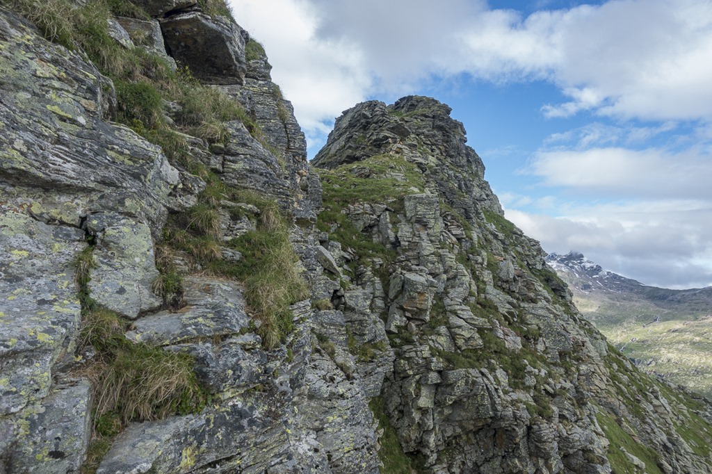
After that it was easy walking on the ridge.
I am wondering how this structure was formed? It is located on top of the ridge so there is not something like the top rock falling off a mountain.
Who can find the tree “Steinböcke” on the following picture?
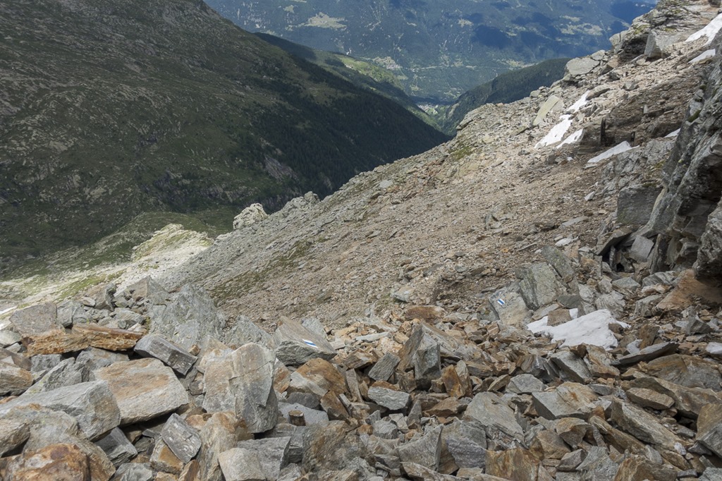
Way down after the forth mountain. Looks scary with lots of loose stones? That’s what I also thought first but the underground turned out to be rather solid and the trail left the top of the picture after some meters.
As I was getting closer to the real end of the via Nicola I was already hiking for 9 hours, which is much longer than I had initially expected for the whole tour. And I still had to get back to my car. So I was looking for options to do some shortcut on the way back. The only option I could identify was instead of walking around the last mountain on the left side to try bypass it on the right side and then join the hiking trail further down on the right side. That would save me 1-2 hours at least. The “little problem” with this short-cut was that I had difficulties to find a way down on the right side.
All options looked extremely steep (180m vertical on 120m horizontal). Even though there was some kind of sign on a stone which was pointing into that direction I decided to not try anything and take the long but save route around the mountain.
My way down to the normal hiking trail. Actually reality feels steeper than this picture but it was doable without any problems.
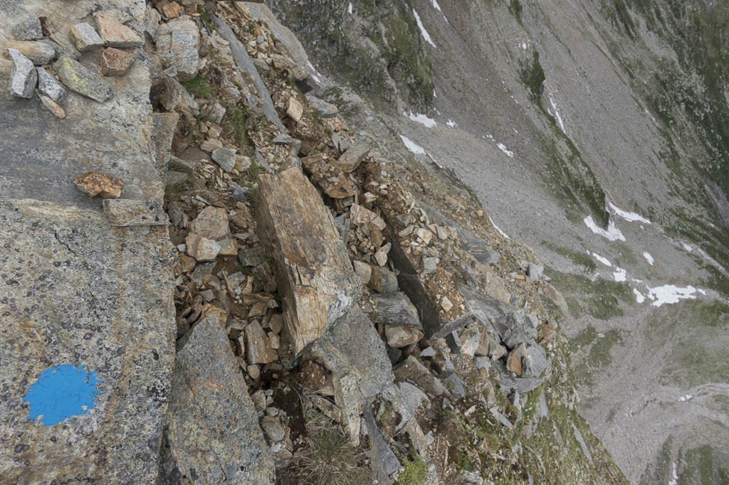
Just a stone.
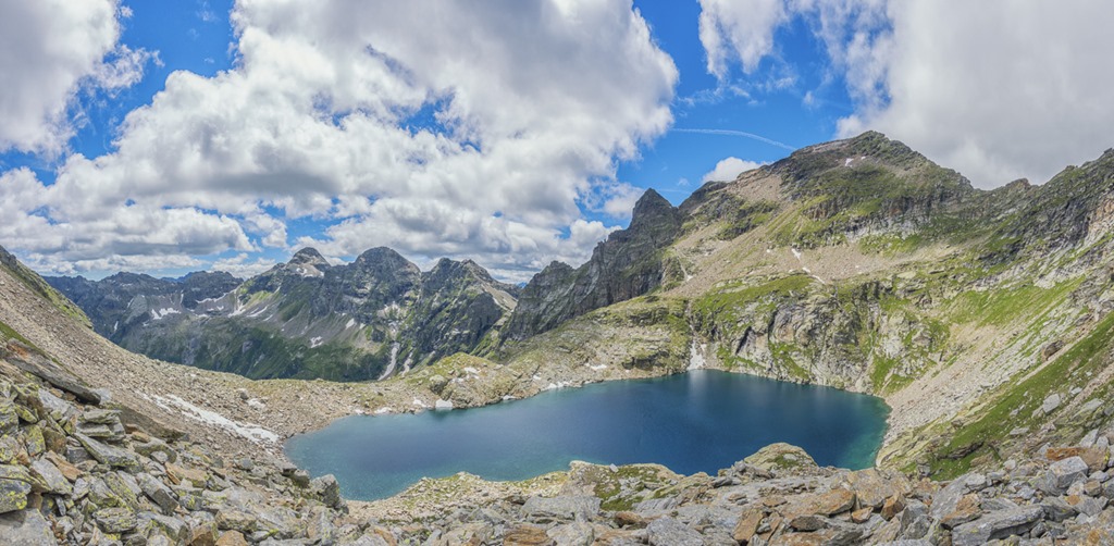
The “easy” way around the last mountain involved some additional 300 meters of climbing up to a pass. The amazing view of another small mountain lake was the reward for this effort.
After the pass the way down was going over big stones. I was very careful to not slip or stumble. This was exactly the situation how I dislocated my shoulder two years ago: Difficult part of a hike over, simple walking back, not concentrating, I fell and had troubles with the shoulder for nearly a year … not this time!
After I reached the grass the hiking rail was getting smoother and I could accelerate to maximum speed just to stop occasionally to take some pictures. I was already 11 hours on the trail and was running low on food. And as weird as it sound I like to run down mountain. When running down I seem to able to much better absorb the impact of the steps with my muscles and never have any pain afterwards.
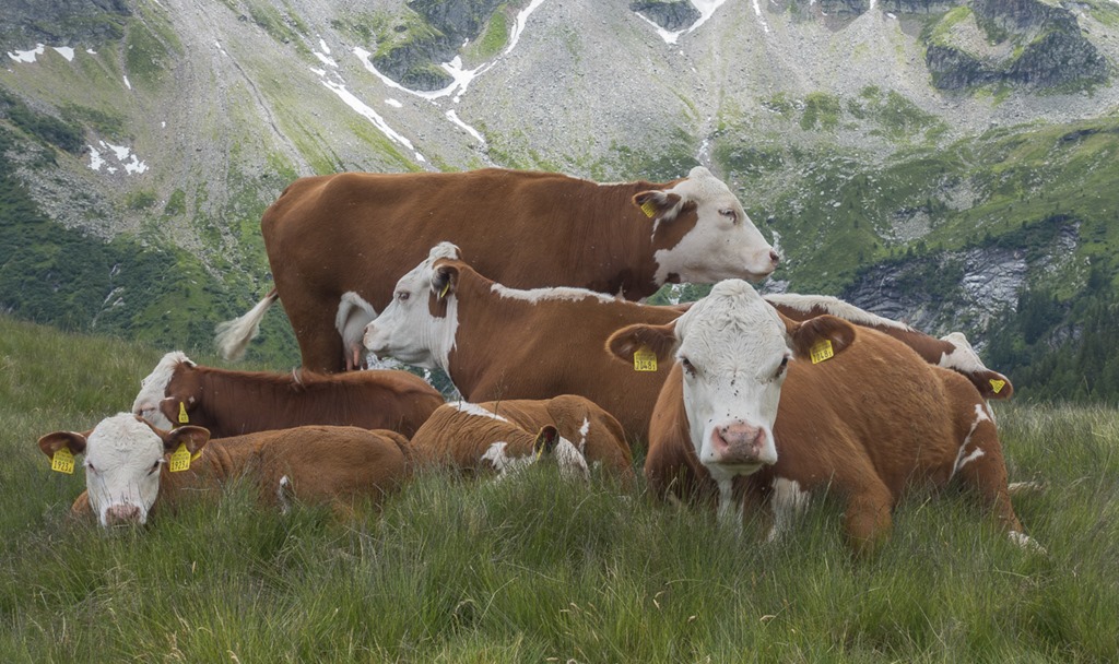
And of course I stopped for this group of happy mountain cows. Happy? They all seem to be pissed of by something. I just could figure out what.
When I reached my car the clock stopped at 12:15h. Wow, that was kind of hike! Amazing experience on the ridge, super adventure in the morning when I was trying to find the right path and a good reconnaissance for the planed multi-day hike. And it was by far the most remote hike I have every done in Switzerland. I didn’t encounter anyone during the whole day.
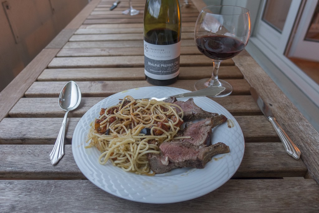
On my way back to Zurich I got a spontaneous invite for a diner. An offer too good to refuse. Cheers!
Distance: 25km
Ascent (meters up): 2600m
Time: 12:15h