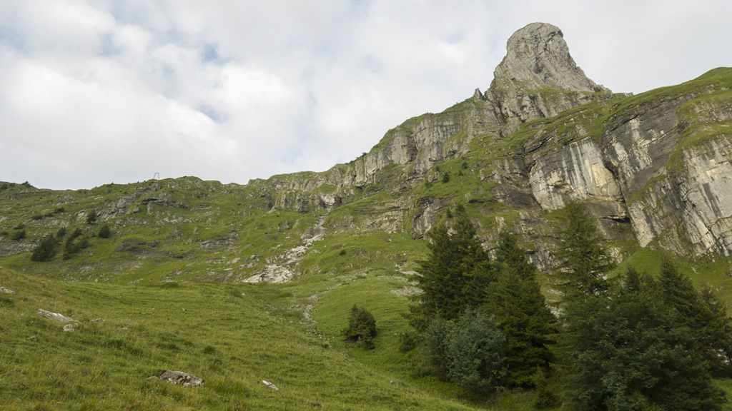
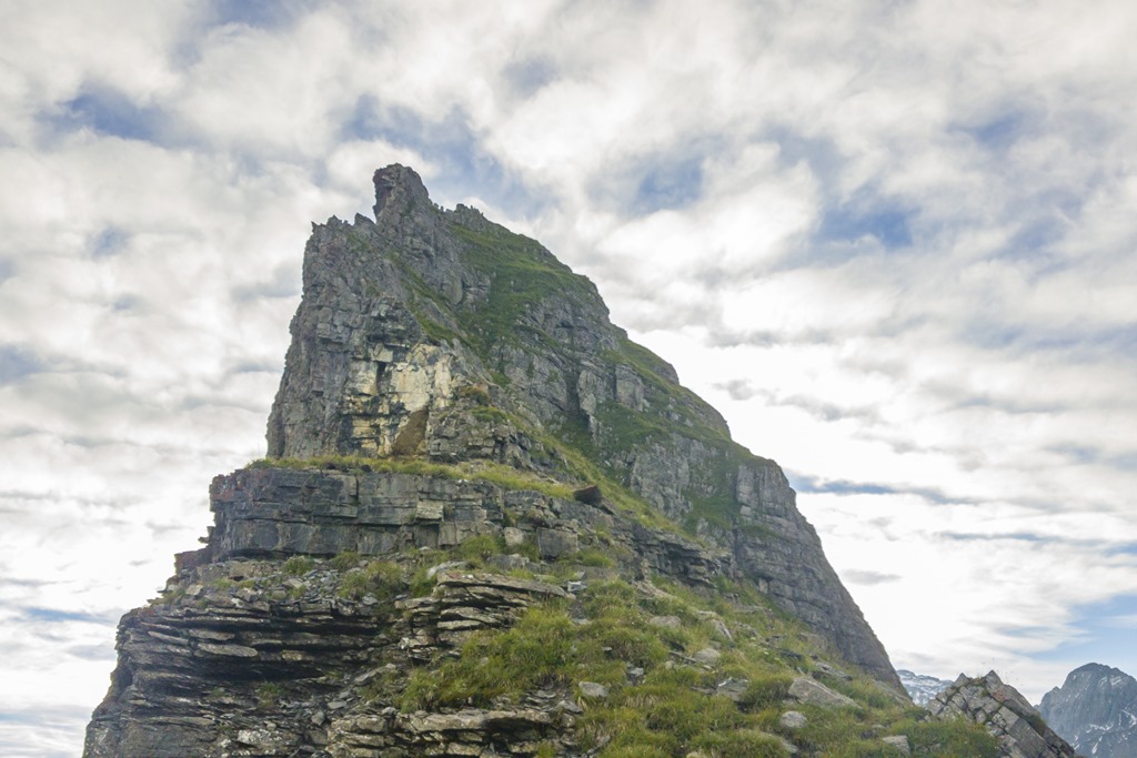
As the weather was getting better and better I decided on Friday to go for a two day’s hike on the weekend. The idea of it was to get into a good position on Friday, stay there for the night and then go early for the summit of “Höch Turm” which can be translated as “High Tower”. Due to its form the “Höch Turm” is considered as the Matterhorn of the Muotathal region. There are several ways to approach it. I wanted to reach it by going over a long ridge (like 5 km) which had two other interesting obstacles to offer: the “Gross” and “Chli Chilchberg”.

Before I left the office I had checked a web cam from the region where I wanted to go. It didn’t look good: Fog with a visibility of less than 50 meters. But the weather forecast was pointing into a good direction so I left nevertheless. And by the time I arrived there all the fog was gone. There were still some clouds but eventually they would go away. The plan for today was very simple: Go up 1000 meters of altitude in order to reach the beginning of the ridge and be in a good starting position for tomorrow. As the official hiking trail was doing quite a number of unnecessary loops I was looking for a short cut. I found a trail through a small valley which was partially marked on the official Swiss map. At least on the map it looked doable and as it was giving a substantial time saving on the way up I was pretty sure that the track was not a dead end and was used by hikers on a regular basis. And I was right. Of course the trail was not maintained and marked like an official hiking trail but it was much more fun in the jungle. 🙂
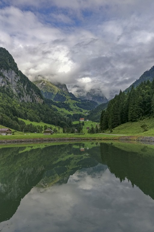
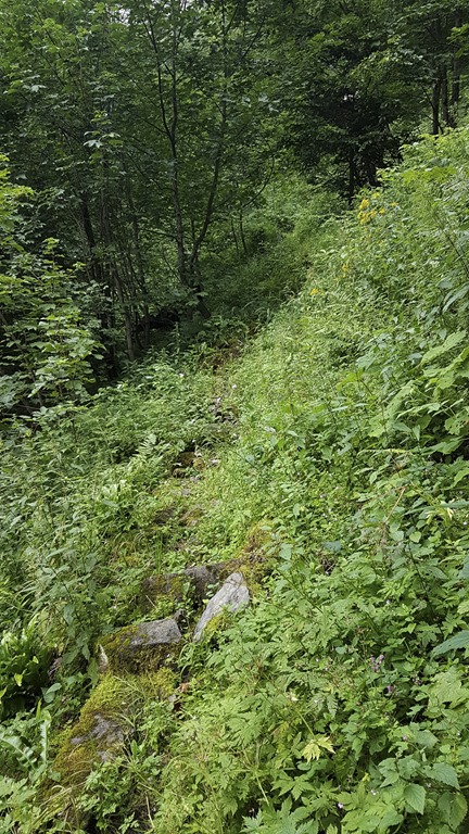
After the jungle I was back on the blue-white marked alpine trail.
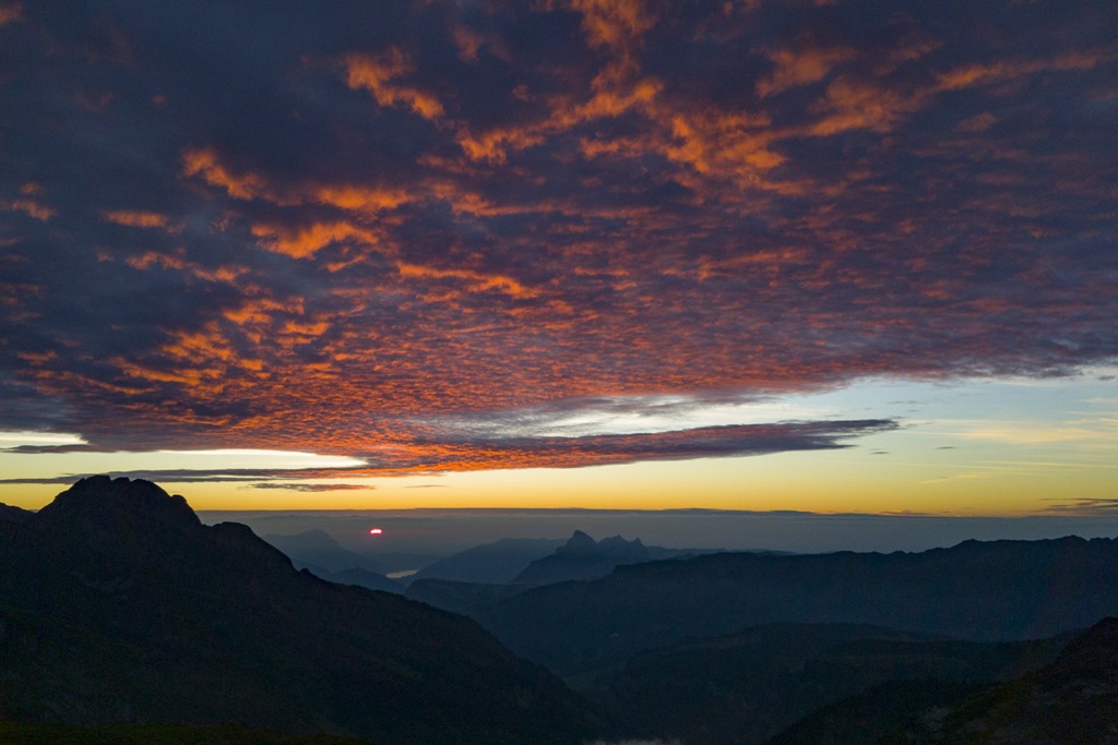
On the way up I thought that I was late for sunset. So I pushed very hard on the speed. But I wasn’t late at all. It was just perfect timing! And the weather was getting better by the minute
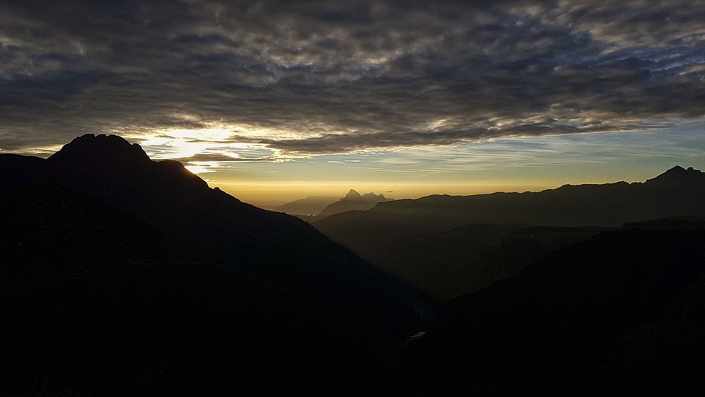
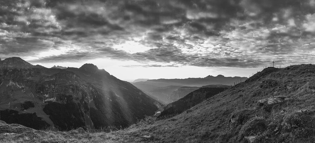
At some point the sun was getting below the clouds and casting it rays into the valleys and mountains.
Disclaimer: All the following pictures have not been artificially changed. I just had to tweak them a bit so they look like reality! Really!
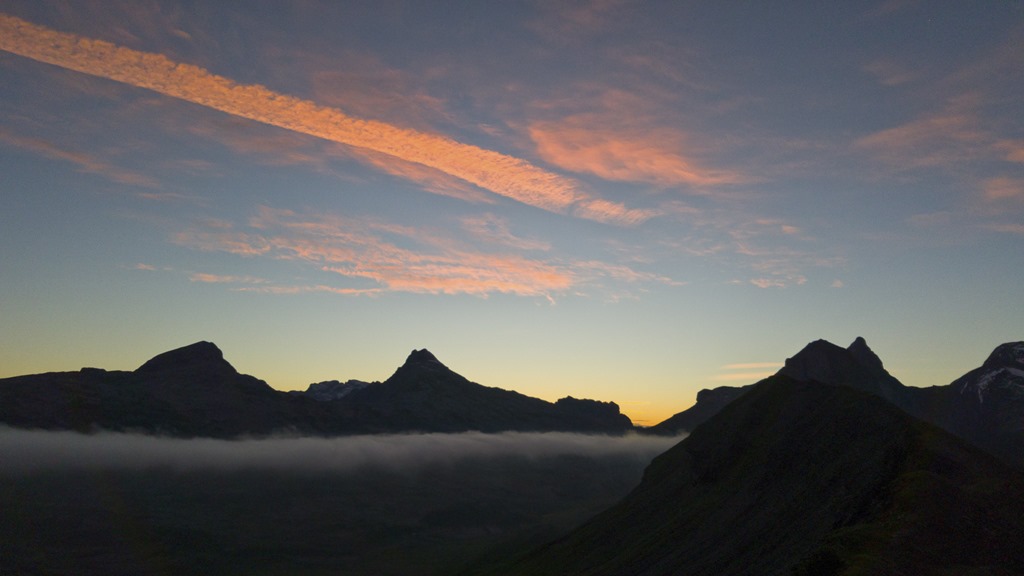
The mountains were glowing in front of the darker clouds.

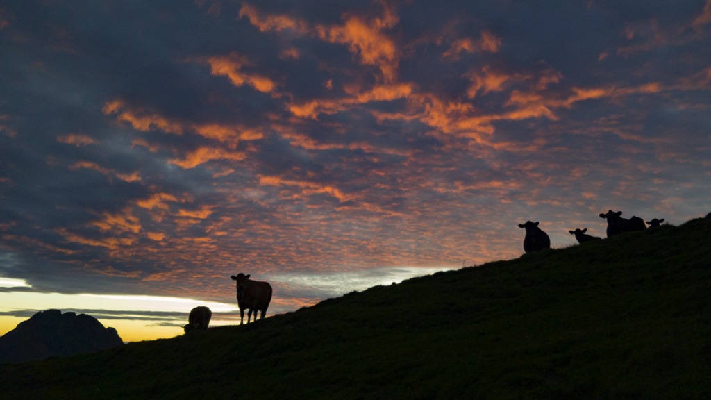
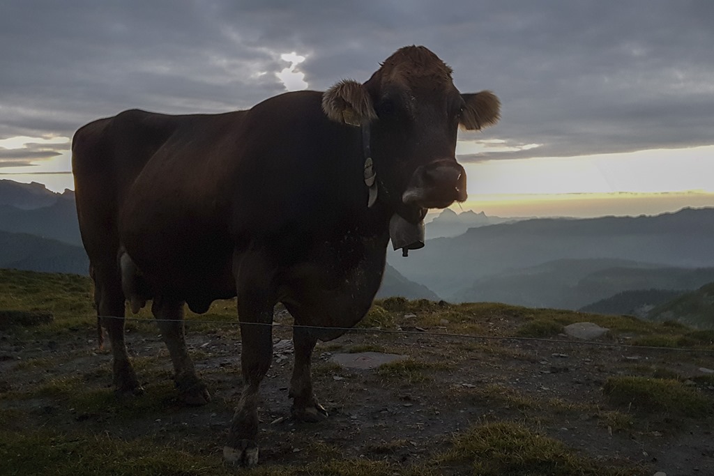
As I was looking for a place to stay for the night I was closely watched by a herd of cows. For them I must have been the attraction of the day.
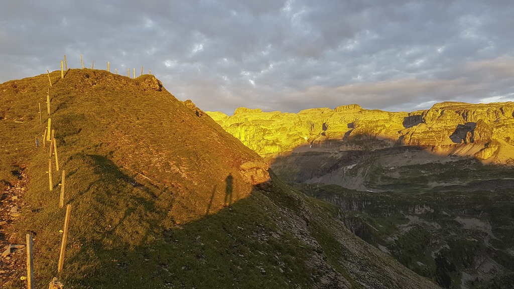
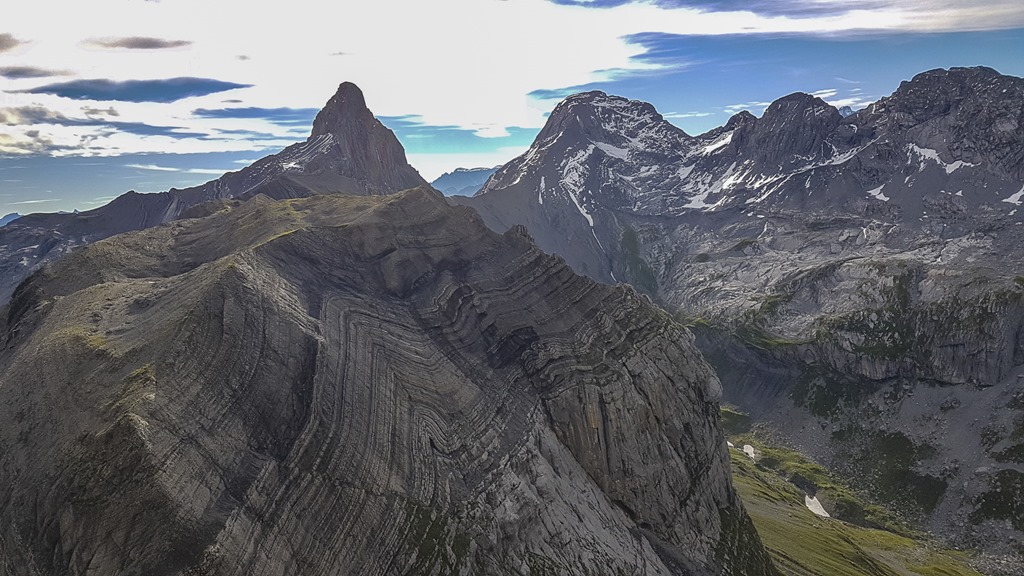
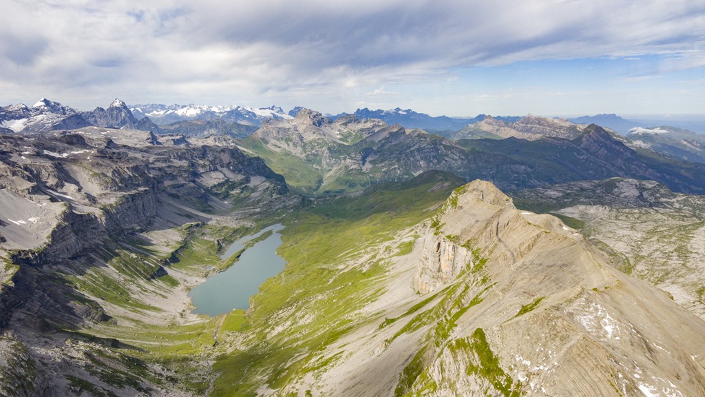
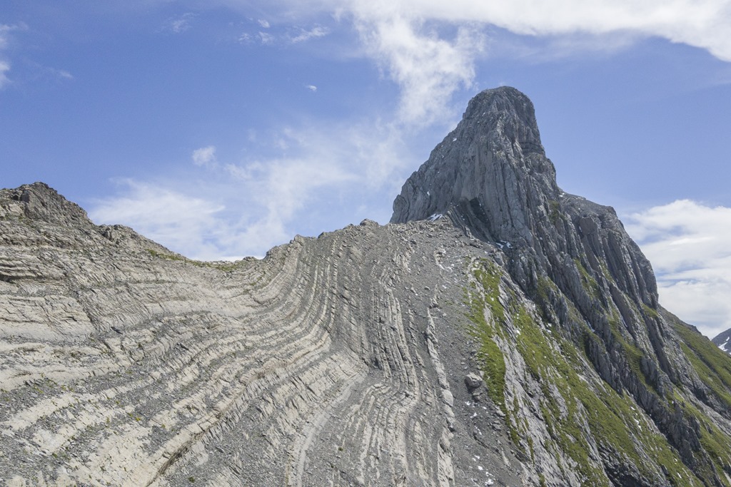
Looking into the other direction I could already see tomorrow’s target, the Matterhorn like “Höch Turm” on the left side of the image.
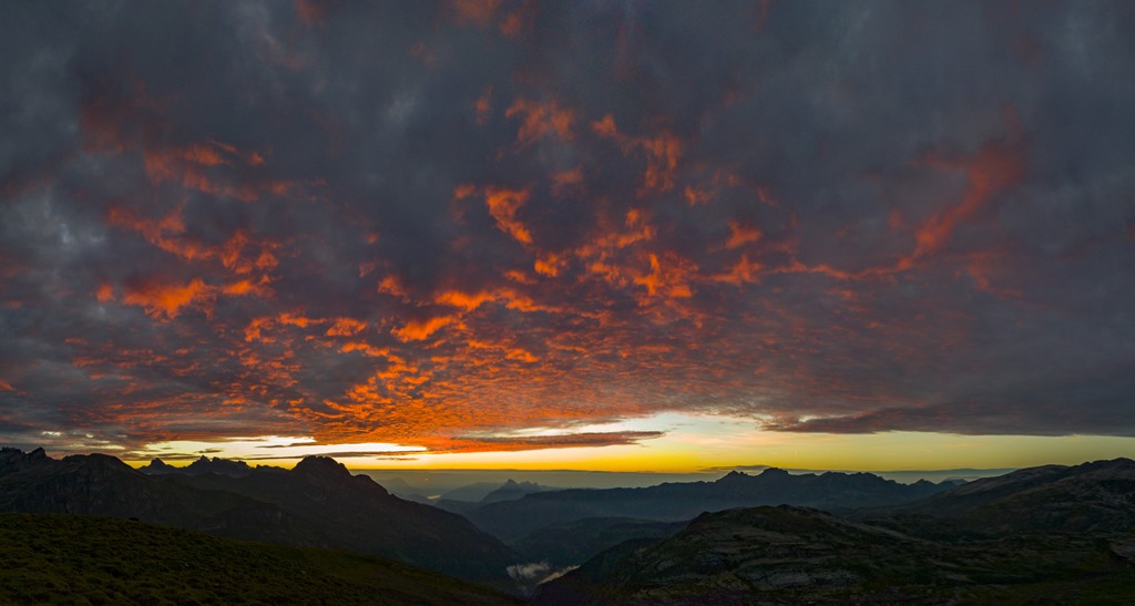
The sun still a bit over the horizon. You can see right in the middle the Mythen mountains where I have been twice this year already. And just below the sun ins the lake of Zug.
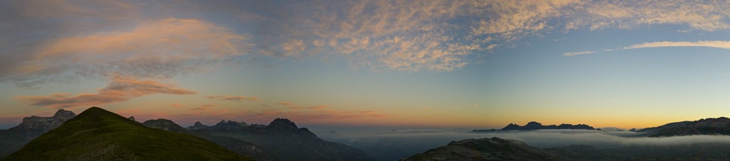
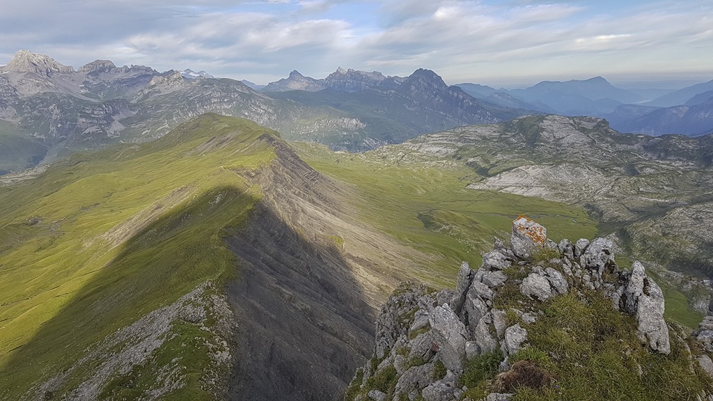
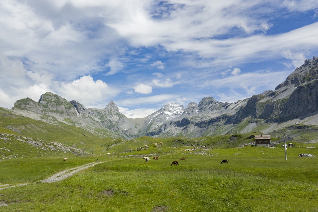
Panorama view of everything. What should I say more: perfect!
While enjoying the sunset I found a nice place to stay for the night. On top of the first “hill” of the ridge. As there was a nice bank of stone it looked like the perfect place to stay for the night.
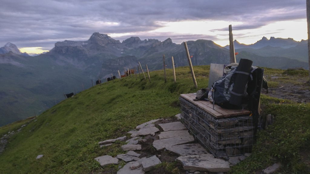
However soon it turned out not to be the perfect place for the night! I was already starting to unpack my stuff the first cow arrived at my place. Those creatures seem to be rather curious or bored or whatever. I am not sure if this cow was a scout but soon all of them were standing next to the bench only separated by an electrified fence. The weren’t hostile or anything, just curious. I could pet even them and they seemed to like it. The only problem was that at least 50% of them had nice bells around their necks and that was creating quite some noise. Even though I tried to ignore them as much as possible they just didn’t move on. So I decided to move on myself to the next small mountain of the ridge which was around 500 meters away as having that many bells so close by would definitely not result in a lot of sleep.
The next mountain didn’t offer the luxury of having a bench but it had one big advantage: No cows around.
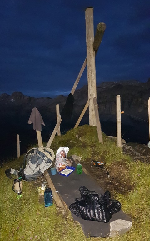
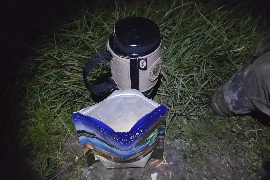
Soon my bed was mad and I could focus on the dinner preparation which translates to heating up 0.5l of water for the freeze-dried food which was astonishingly tasty. While waiting for it to be ready I had a salad. Two course menu in the mountains. There is nothing to complain about.
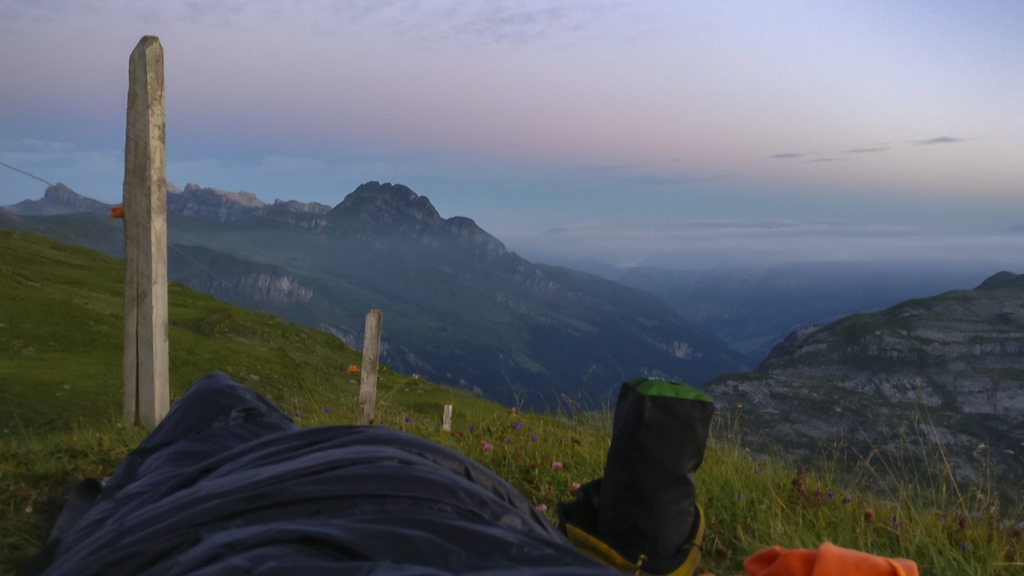
First light of the new day. This is what I call a bed with a view!
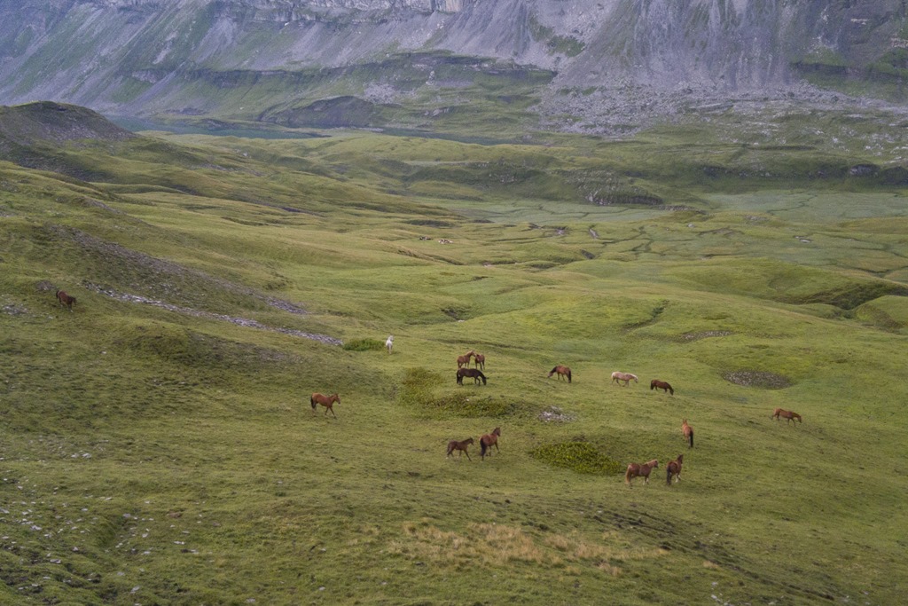
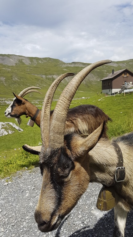
There were many horses in this area. And the funny part of it was that the horses also had small bells.
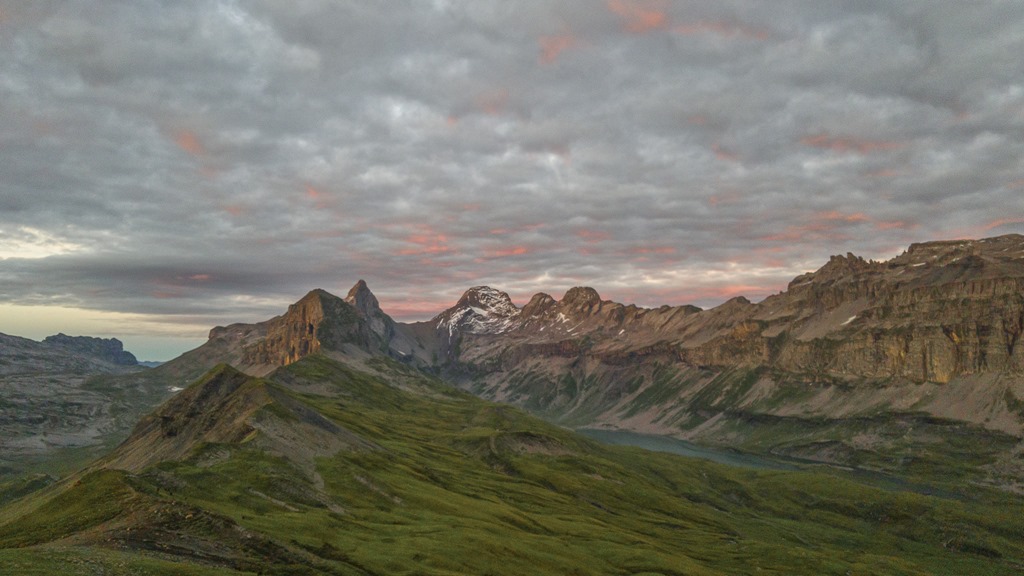
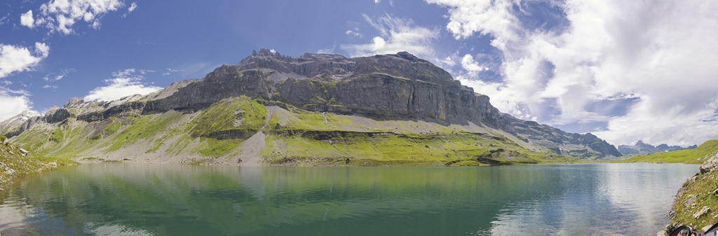
Another panorama shot.
My experience is that in the mountains you go to bed when it is getting dark and you get up when the sun is coming up again. The sun was getting up short before 6 so that is when I started to pack my stuff.
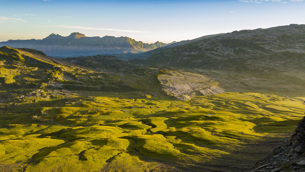
After having some breakfast and a coffee I started my hike towards the “Höch Turm”. I was basically just following the ridge which eventually ended up on the tower. The early light was turning the meadows below into a mystic landscape.
On my way to the “Höch Turm” I had two other mountains in my way which were of similar difficulty compared to my target. It was the “small Chilchberg” and the “big Chilchberg”. The first one, the small, wasn’t causing any issues.
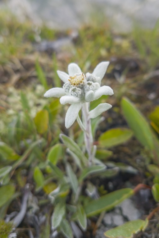
Here I saw the first “Edelweiss” of this year. While there are nicer flowers around it is probably the most iconic of the Alps with many symbolic references.
Looking back from the “Chli Chilchberg” (Chli = small in Swiss German) to the ridge.
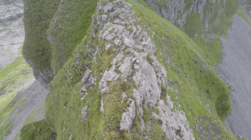
Now this was the point were the real fun started. The section between the small and the big Chilchberg was a narrow ridge with steep flanks on both sides. I would say that this was as narrow and steep as it can get for a grass flank.
You just need to focus on the next step and everything is fine! You don’t need a track which is 2 meter broad to walk. 25cm is enough ![]()
Looking back to the narrow ridge.
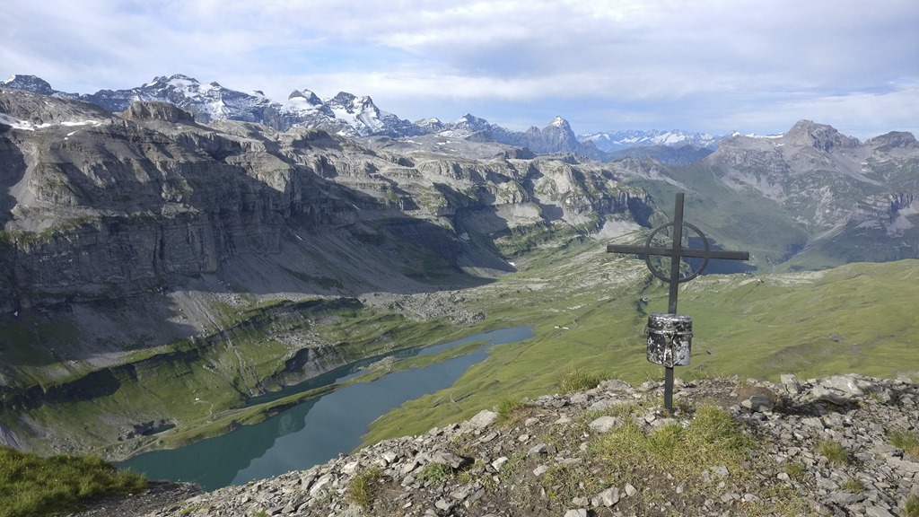
From the top of the big Chilchberg you can see a little lake. That looks like a nice place to take a bath in the afternoon when returning.
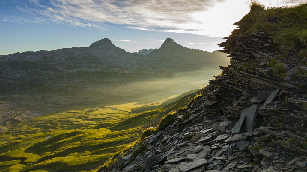
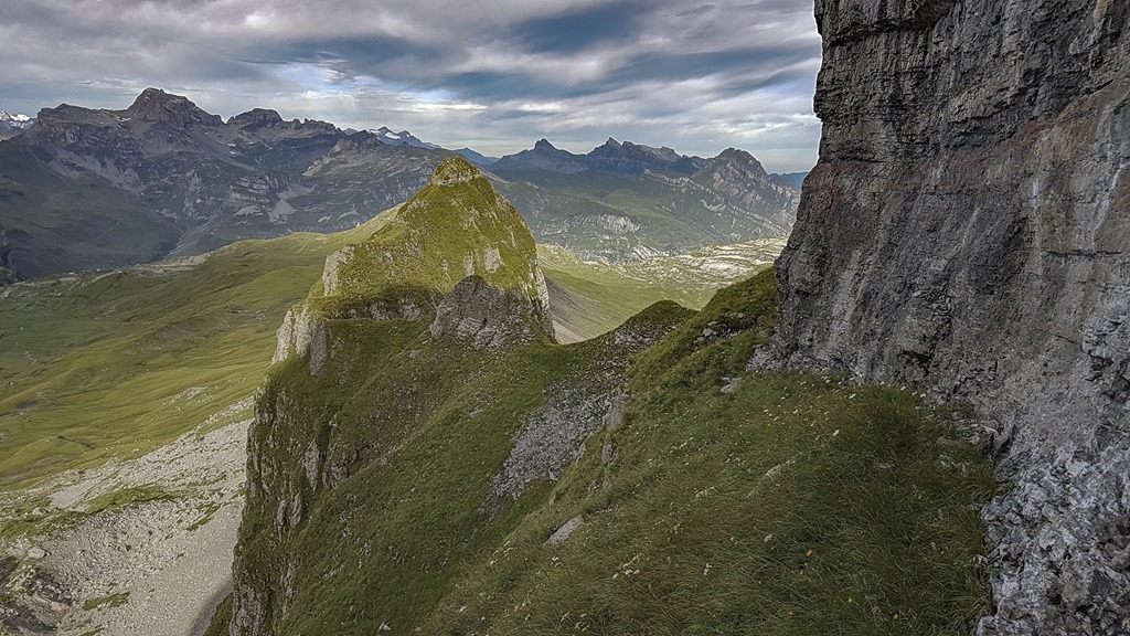
The “Höch Turm” was already getting closer.
After the “Gross Chilberg” the ridge was getting broad and easy. So I could watch the surrounding area even when walking. Here you can see a fantastic formation of stone. At some point another hiker overtook me. He wasn’t taking as many pictures as me and it was obviously not his first time here.
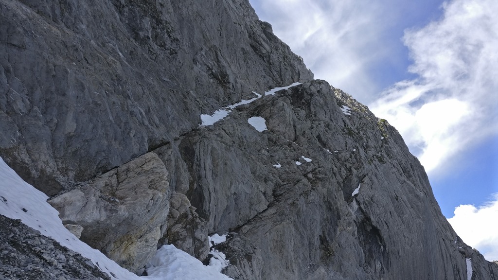
At this point I was already very close to the tower. I had decide to take the option of the “second band” to go up and potentially the third to go down.
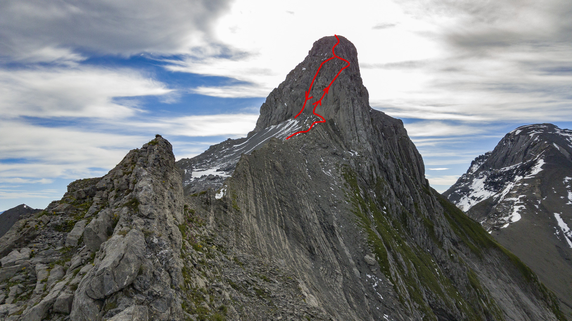
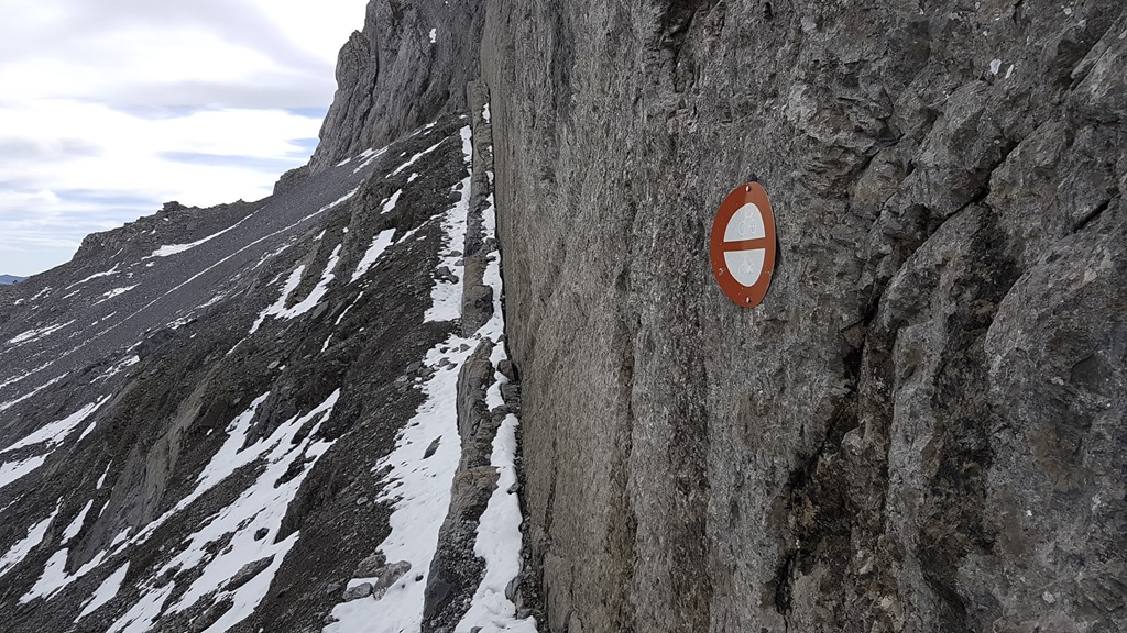
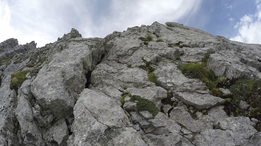
You can’t hike up this mountain just by following the ridge to the top. The lowest section is a climbing only area. But there are three bands from the left side to the ridge which allow you to bypass the lowest section of it. The first band is again not something for hiking so some funny guy put a no-drive sign there.
The second band was the one I picked for my way up and as the following picture shows it is rather doable.
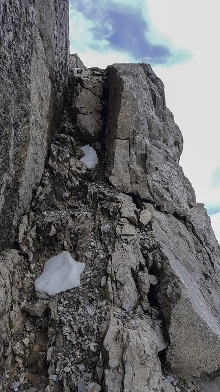
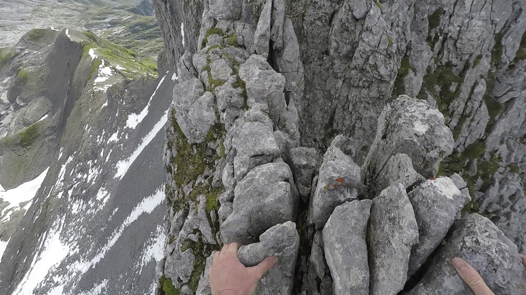
There is one caveat though. The final meters to the ridge are through a nearly vertical wall. However the rock is very solid with many good places to grip.
You just need to ignore what is behind you (=lots of air) and everything is fine.
Once on the ridge the way was clearly given: Just stay on it to the top.
On the top I met the same hiker again. We had a small talk and it turned out that he is doing this tour on a regular basis. I was slightly astonished by the fact that he was wearing all possible climbing security gear. But he told me that he intended to go around the mountain which potentially required that.
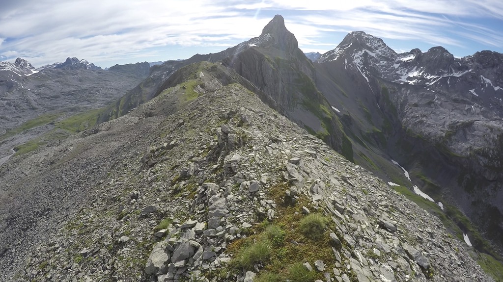
View from the top of “Höch Turm” including the ridge on the right side which I used to get up here.
The summit book was only 10 years old but already in a rather bad shape. So I ask everybody to go the “Höch Turm” and write some story into the book so it is filled up fast and can be replaced.

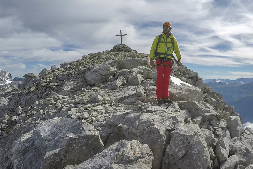
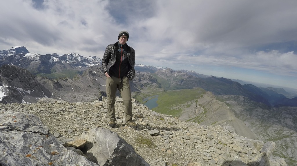
Marco trying to dry his went shirt. In fact it was kind of dry after 20 minutes,

Today’s summit picture is sponsored by Gopro since I left the memory card for my camera at home and had to take all pictures with my mobile.
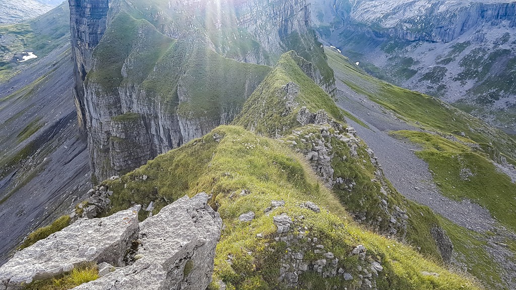
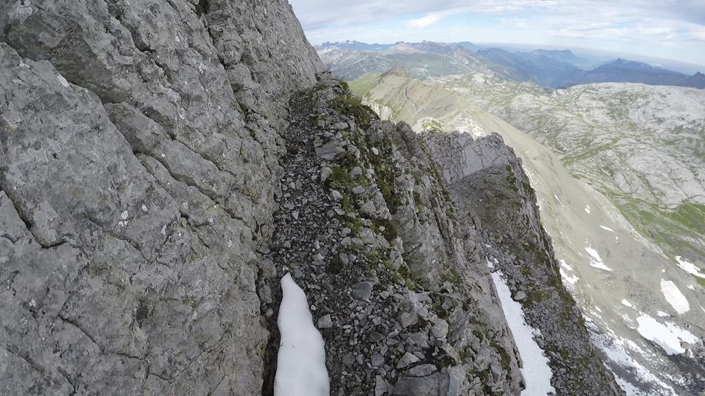
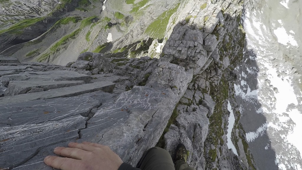
In my mountain hiking book there is a statement about the hike to the “Höch Turm”: You can very much enjoy the nice view from the top if you don’t think about the way down. Yes, the way down is the same as the way up. But you are just facing the opposite direction meaning you get all the nice view you can imaging. The following picture gives a impression how it looks on the ridge.
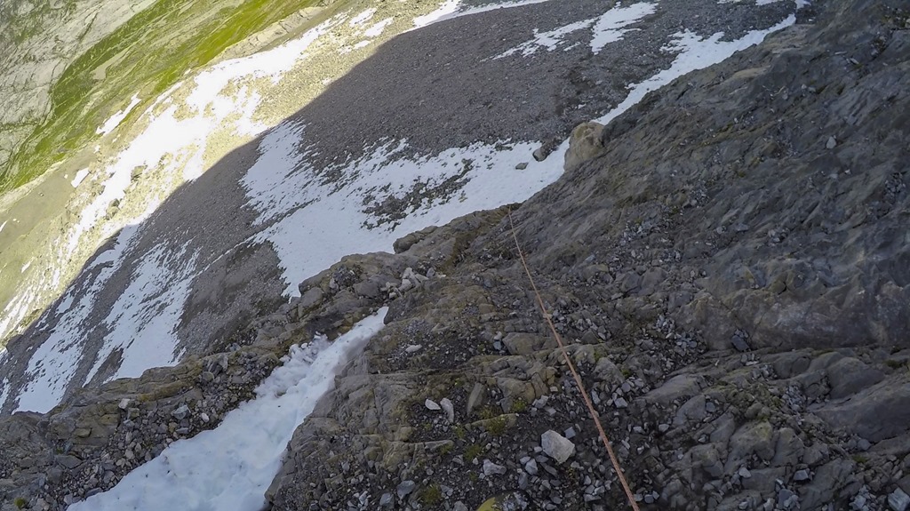
On the way down – after I had a chat with the other hiker on the summit – I decided to choose the third band. I thought that maybe climbing down the vertical section of the second band could be more difficult. But he third band was not simple after all! It was still covered with quite a bit of snow, the underground consisted most of the time of a slightly tilted “polished” rock and there where many times no good options for a solid grip. I had observed the other hiker from above and was wondering why he was moving so slow in this section. Now I knew … So, there I was in the third band struggling to get down. A couple of times I was thinking of going up again to pick the second band, but I was already down quite a bit and the other guy also didn’t return. Slow but steady I made it down, But I was definitely not getting any points for extraordinary style or elegance.

At the lowest section of the third band there was a fixed rope installed.
The third band doesn’t look too spectacular from below.
As I was down from “Höch Turm” I only had to find a way down to the valley. Remember what I was talking about before: Taking a bath in the mountain lake was my target. The problem with getting down into the valley was caused by the fact that I didn’t have any mobile signal up there to check the maps on my phone. And the way down was not visible from the top of the ridge. So I decided to try the first option which seemed to be doable. Too bad that after descending 300 meters of altitude I was stopped by a vertical cliff of 30 meters and too bad times two was that my “emergency” rope was only 20 meters in length. Sooo, long story short: I had to get all the way up again to the ridge…
Eventually I got the mobile signal back and found a place to go down from the ridge. Soon after I was standing at the bank of the mountain lake and ready for a refreshing swim.
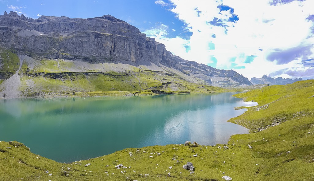
The refreshing swim had a abrupt stop when I entered the water and all my nerves in the legs were sending an “abort mission” message to the brain. This lake was very nice to watch but the water was just many many degrees too low in order to enjoy something like a swim.
As it was already well into the afternoon I decided to take the cable car back down to my car. Lazy, lazy me!
View back to “my” ridge on the left side of the picture.
Completely unrelated but nevertheless worth mentioning: After the hike I went to my hut in Arni. And there I could witness some nice rainbow around the Bristen mountain, which is one of my next targets for this year. The plan is to camp on top of it which requires a perfect day without thunderstorms.

Statistics for the hike:
Duration: 2h + 7:30h
Ascend: 950m + 1100m
Distance: 4.3km + 14.5km